
Jourama Falls track, Paluma Range National Park
ID: 56b262e9d5f1565045da6941Ingham, Queensland
Ingham,
Queensland
4850.
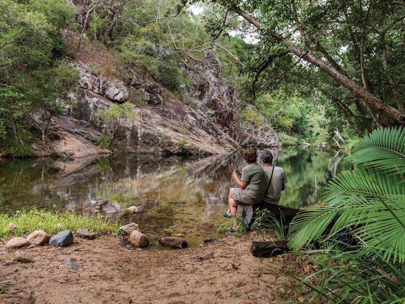
In the Jourama Falls section of Paluma Range National Park, Waterview Creek tumbles down many picturesque cascades and rapids, offering beautiful spots to relax, camp, walk and enjoy watching birds, butterflies and other native wildlife. Rainforest grows on the higher slopes and fringes of the creek. Poplar gum, bloodwood, Moreton Bay ash and cocky apple trees are common in the open woodland. Jourama Falls track starts at the end of the road, 700m past the main camping area. This pleasant walk through open woodland leads you to a creek crossing. At the signposted junction, about 100m beyond the creek crossing, continue to the lookout or visit the creek further upstream. The 600m track to the lookout is all uphill but you will be rewarded with views out over the falls and the surrounding rainforest. On the return leg, stop to explore the creek and its lush vegetation. You can even slip into the clear water to cool off....
Product Types
- Trails
Accessibility Information
- Disabled access available, contact operator for details.
Activities you can engage in
- Birdwatching
- Camping
- Swimming
- Walks
Itineraries
Jourama Falls track, Paluma Range National Park
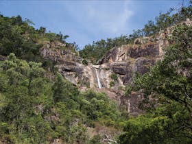
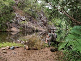
In the Jourama Falls section of Paluma Range National Park, Waterview Creek tumbles down many picturesque cascades and rapids, offering beautiful spots to relax, camp, walk and enjoy watching birds, butterflies and other native wildlife. Rainforest grows on the higher slopes and fringes the creek. Poplar gum, bloodwood, Moreton Bay ash and cocky apple trees are common in the open woodland. Jourama Falls track starts at the end of the road, past the main camping area. This pleasant hike along the creek to the lookout is well worth the reward. At the signposted junction, just beyond the creek crossing, continue to the lookout or visit the creek further upstream. The 600m track to the lookout is all uphill but you will be rewarded with views out over the falls and the World Heritage-listed landscape. On the return leg, stop to explore the creek and its lush vegetation. You can even slip into the clear water to cool off. This walk is managed by the Queensland Parks and Wildlife Service. The map only shows an indicative start point; the track route and end point are not shown, and the map cannot be used for navigation purposes. See www.des.qld.gov.au for detailed maps and the latest park information. When you are in the park, read the signs at and near the start of the track.
Facilities found here
- Carpark
- Lookouts
Travel Method
- Walk
Route Type
- Return over same path

Back To Search
