Maribyrnong River
ID: 56b24dc03ed14ca74532a91dMaribyrnong, Maribyrnong, Victoria
Maribyrnong,
Maribyrnong,
Victoria
3032.
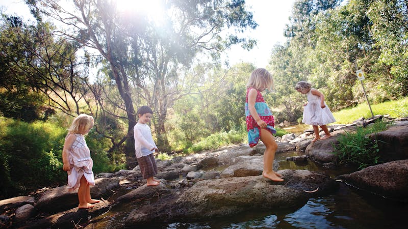
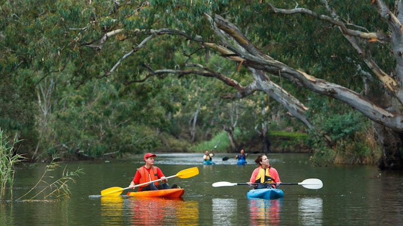
The Maribyrnong River, which begins on the slopes of Mount Macedon and flows to Port Phillip, has played a major role in the occupation and development of western Victoria. Aboriginal tribes have frequented its banks for at least 40,000 years. These waters provide good canoeing and three ponding points have been designed to enable children and adults to discover the delights of catching fish with a hand net. The park has barbecues, picnic tables and shelters, and a shared cycle/walking path starts in the park and continues on to Footscray. Parklands on either side of the river include Maribyrnong Park and Fairbairn Park where there are boat landings and picnic facilities. Bicycle tracks follow its banks, crossing the river via pedestrian bridges at several points. Many people use these trails to get to Brimbank Park or Pipemakers Park. Before you go Conditions can change in parks for many reasons. For the latest information on changes to local conditions, please visit the relevant park page on the Parks Victoria website. Be bushfire ready in the great outdoors. Refer to the Bushfire Safety section on the Parks Victoria website for tips on how to stay safe. ...
Product Types
- National Parks and Reserves
Facilities found here
- Carpark
Back To Search